Dobrý den chtěl jsem se prosím zeptat zda na tomhle typu gps lze nastavit bod ke kterému mě gps dovede? a kolik je mozno uložit bodu(pozic) Děkuji za odpověd.
Garmin eTrex 10 Handheld GPS
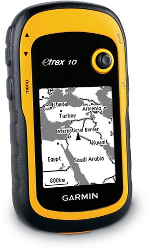
Personal Navigator - GPS and Glonass, sun and moon application, compass, 2 x AA batteries
Show full description
Code:
PP564b29
Producer's Website:

Garmin eTrex 10 Handheld GPS
Discontinued
Garmin eTrex 10 Handheld GPS
Garmin eTrex 10 non-map navigation can receive and record data from US GPS, Russian GLONASS and, in the future, European GALILEO satellites. It achieves higher accuracy especially in places with limited view of the sky. There are currently 12 (24) satellites available to determine the position. eTrex 10 has undergone a complete change. It offers an enhanced user interface or added new paperless Geocaching features... Supports recording of descriptions directly from Geocaching.Com or OpenCaching.Com and directly supports GPX files. Information about the Sun and Moon phases and rises or the plot of land measurements are new to this class.
Advantages of combined GPS navigation and Russian GLONASS satellites.
The more satellites the receiving device can receive, the more accurately it will determine your position. The standard GPS navigation has 12 satellites under ideal conditions, out of a total of 24 (12 of them are always behind the horizon). However, in the case of a combination of both systems (GPS and GLONASS), the device has twice as many satellites, 24, available. This lets your navigation device vie you a more accurate position, especially in places with a limited view of the sky.
Parameters and Specifications:
Display:
Type: LCD with four levels of grey
Resolution: 128 x 160 pixels
Properties:
Basemap
High-sensitivity receiver
Customize the appearance of screens
GPS receiver
Electronic compass
Geocaching mode
Hunting/fish calendar
Sun/Moon info
Desktop Calculation
Waterproof IPX7
Custom POIs (add POIs)
Power supply:
Battery: 2 x AA
Battery life: up to 25 hours
Dimensions:
5.4 x 10.3 x 3.3cm
Standard Packaging:
eTrex 10 navigation device
Data USB cable
Instructions for use

Garmin Würzburg GmbH, Leightonstraße 7, 97074 Würzburg, Německo, www.garmin.com, [email protected]
Note:
Specifications can be changed without notice. Images are for illustrative purposes only.