


Small Carpathians 52x100cm Laminated, Wall Map with Rods
Don't like the alternatives? Choose from the full product list


Small Carpathians 52x100cm Laminated, Wall Map with Rods
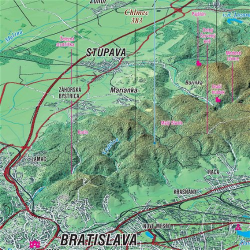
The wall map with white plastic strips has a pleasant colour display and is resistant to UV radiation and mechanical damage thanks to lamination. The colours are permanent and rich, the surface can be easily washed with a damp cloth and you can write on it and draw with an erasable marker . Map of the Little Carpathians panoramic laminate measuring 52 × 100 cm from the Panoramic Map of Slovakia edition provides a view from the southeast, while Bratislava is captured in the lower left year. The map of the Little Carpathians shows colour-coded elevation, nomenclature and descriptions of peaks, basins and tourist attractions, altitude, hiking trails and towns and villages.
Key features of the map of the Little Carpathians panoramic laminate
- The wall laminated map has white plastic strips
- The geographical representation of the Little Carpathians is resistant to UV radiation and mechanical damage
- You can write and draw on the map with an erasable marker and clean it with a damp cloth
- With colour-coded elevation
- On the map of the Little Carpathians you will find nomenclature and descriptions of the most famous peaks, basins and other tourist attractions.
- With towns, villages and hiking trails
- Great teaching aid for schools, accessories for tourist centers and as a decoration
- The geographical aid is described in the Slovak language
Little Carpathians seen by tourists
Map from the edition of the Panoramic Map of Slovakia, which focuses on tourist attractions, offers a great view of the Little Carpathians. Great as a geographical or tourist aid and as a decoration. The map is described in the Slovak language.
Dimensions:
52 × 100 cm
Specifications
Age and intended use
Dimensions
Type
Features
Maps
Specifications can be changed without notice. Images are for illustrative purposes only.