Garmin Topo Czech PRO 2015, microSD/SD card

Don't like the alternatives? Choose from the full product list
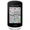

Garmin Topo Czech PRO 2015, microSD/SD card
Do you want to provide your Gamin navigation even more extensive information about the Czech Republic? The Garmin Topo Czech PRO 2015 memory card is the right solution for you then. The memory card features several important improvements over the past, such as refining the surface and the size of newly reduced or enlarged objects, nicer graphics for better clarity, or the addition of several thousand of flat, line and point elements. The Garmin memory card, with a detailed map of the Czech Republic, serves not only as a useful companion on your travels but also as a clever helper in discovering new places of our promised land.
Key features of Garmin Topo Czech PRO 2015
- A memory card with a detailed map of the Czech Republic
- Designed for Garmin navigation
- Contains information about roads, natural elements, and points of interest
- High accuracy mapping
- Modifies the shapes of newly enlarged or reduced objects
- Many improvements compared to the older version
- Nicer graphics of the Garmin map for better clarity
- Also mapped an area of 2km beyond the borders
- Plan route options for different types of activities
- Together, it offers 4,975,000 lines, 4,211,000 surface elements and 370,000 points
Important map elements
- Tourist routes - 45,600 km
- Bike routes - 39,000 km
- A network of forest trails, footpaths and pavements - 326,300 km
- Unroutable roads and trails - 103,400 km
- Residences, including local parts and hermitages - 25,000 points
- Buildings and their blocks - over 3,000,000 elements
Garmin Topo Czech PRO 2015 news
Garmin developers have been really busy since the release of the previous version which is apparent by the comprehensive list of places added in the Czech Republic and a processed area of 2 km beyond its borders. In terms of surface elements, Garmin Topo Czech PRO 2015 memory card has been enriched by adding water surfaces, swamps, playgrounds, rocks, car parks and newly even sets of elements. The line elements have been upgraded with an accurate update of cycling and hiking routes together with the addition and correction of the road, rail and cable car networks. Moreover, the point elements gained a new layer of veterinary surgeries, completion of maternity and elementary schools and extensive replenishment of mountain lodges, peaks, saddles, ski resorts, churches and hermitages.

Garmin Würzburg GmbH, Leightonstraße 7, 97074 Würzburg, Německo, www.garmin.com, [email protected]
Specifications can be changed without notice. Images are for illustrative purposes only.